About Arak
Geographical and Climatic Position
Arak is one of the most strategic and key cities in Iran, located in the heart of the country within Markazi Province. Historically, Arak has played an important role in Iran’s industry, culture, politics, and economy and is currently known as the “Industrial Capital of Iran.” Let’s explore Arak from various perspectives.
Arak County lies in the southwest of Tehran Province, about 288 kilometers away, and serves as the capital of Markazi Province. It borders Saveh to the north, Hamedan to the northwest, Malayer, Khomein, and Aligudarz to the west, Mahallat to the east, and Tafresh and Ashtian to the northeast. Arak covers an area of 7,178.98 square kilometers, constituting about 24.4% of the province’s total area.
Geographically, Arak is situated at 34°5′30″ N latitude and 49°41′30″ E longitude. The Arak plateau spans 5,400 square kilometers, with 2,400 square kilometers forming the elevated Arak plain and the rest consisting of surrounding mountains. The region’s main mountain range extends from the northwest to the south and then turns northeast, while a second parallel range stretches from south to north, widening in certain areas and even crossing the northwest part of the city.
Arak’s climate reflects the characteristics of Iran’s central plateau: cold, wet winters and hot, dry summers. The surrounding mountains, the Meyghan Salt Lake, and the Farahan plain all influence the local climate. In autumn and winter, western clouds release most of their moisture over the western highlands, particularly the Zagros Mountains. A cold front often settles in Arak during winter and, due to the surrounding elevation and pressure effects from Meyghan Lake, remains for an extended period.
The city experiences variable weather: winters last 4 to 6 months, while spring and autumn are brief. Summer mainly occurs during July and August. The number of frosty days varies between 65 and 120 annually. Rainfall ranges from 230 to 638 mm per year, with an average of about 300 mm.
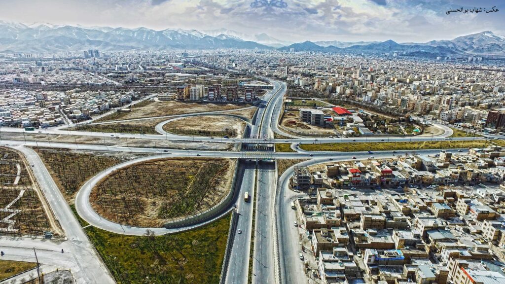
A view of Arak
Historical and Tourist Attractions
Historical Sites:
Arak Bazaar Complex: Built during Fath-Ali Shah Qajar’s reign, this bazaar features amenities like mosques, schools, and water reservoirs, arranged in a cross-shaped layout.
Four-Season Bathhouse: A beautiful Qajar-era structure with sections for men, women, and religious minorities. The dressing area is adorned with colorful tiles and now functions as a museum.
Sepahdar School: A Qajar-era school built by Yusef Khan Sepahdar, featuring Safavid architectural influences and Qajar-style tilework.
Pir Moradabad Shrine: Located in Moradabad village, 14 km northeast of Arak, originally built by Shapur II and later rebuilt during the Seljuk era.
Imamzadeh Mohammad Abed Shrine: A Safavid-era shrine for the son of Imam Musa al-Kadhim, situated 12 km north of Arak.
Borzuyeh Fire Temple (Rahgard): A Sassanid-era Zoroastrian temple built of brick and stone in Rahgard village, 65 km northeast of Arak.
Haj Vakeel Castle: A Qajar-era structure that once housed a major carpet workshop and the British consulate in Arak.
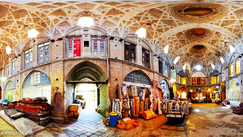
Arak Bazaar
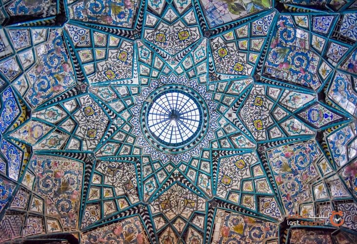
Four-Season Bathhouse
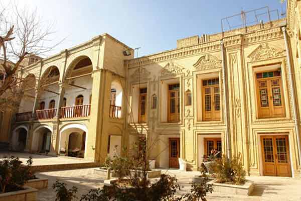
Haj Vakeel Castle
Natural Attractions:
Chepeghli Spring: Located in the northern slopes of the “Bagh Bar Aftab” highlands, with therapeutic waters and scenic terraces.
Khosrow Spring (Sarab-e Hak): A large spring on the Rasvand Mountain foothills in the Kazzaz plain, known for its lush surroundings.
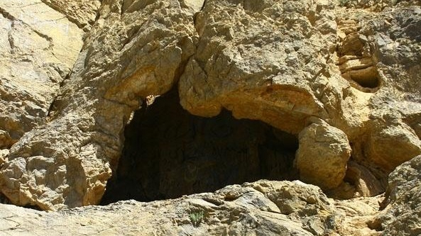
Sefidkhani Cave: Situated 18 km south of Arak in the Sefidkhani mountains, famous for its “genie chimney” and stalactite formations.
Anjedan Cave: Located 40 km southeast of Arak, between Khomein, Arak, and Mahallat, famous for its caves and historical sites.
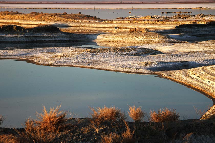
Meyghan Lake/Desert: A salty lake/desert northeast of Arak in the Farahan plain, covering 100–110 square kilometers and hosting migratory birds in autumn and early winter.
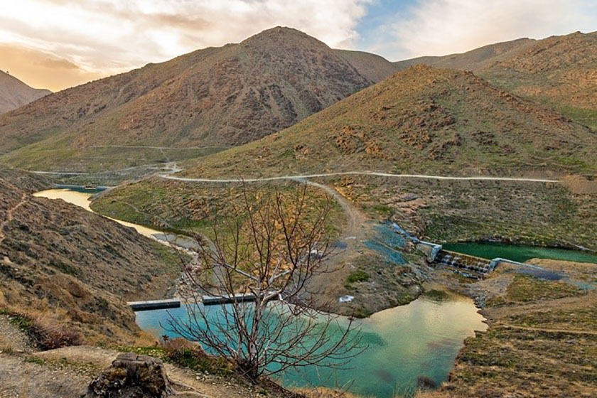
Gerdoo Valley Tourist Area: A 100-hectare area south of Arak, designated a tourist site by the Iranian government in 2006.
Sefidkhani Cave
Meyghan Lake
Gerdoo Valley
Handicrafts and Souvenirs
Arak is known for its traditional crafts including:
Handwoven textiles (carpets, kilims, jajims)
Traditional embroidery
Woodwork (carving, marquetry, sculpture, turning)
Pottery and ceramics
Traditional calligraphy and painting
Metalwork (copper, engraving, filigree)
Traditional footwear (Giveh weaving and stitching)
Architectural decorations (plasterwork, mirror work)
Gemstone carving
Carpet weaving has deep roots in Arak, with Sarouk, Farahan, and Sarband rugs gaining global recognition. Under Yusef Khan Gorji’s patronage, carpets became a key export. At one time, Arak’s rugs rivaled those of Kerman. The Sarouk carpets are especially renowned for their durability, unique designs, and fine wool. Arak remained a major exporter until 1940. Local food souvenirs include baslogh, fatir bread, grape molasses, and grapes.